
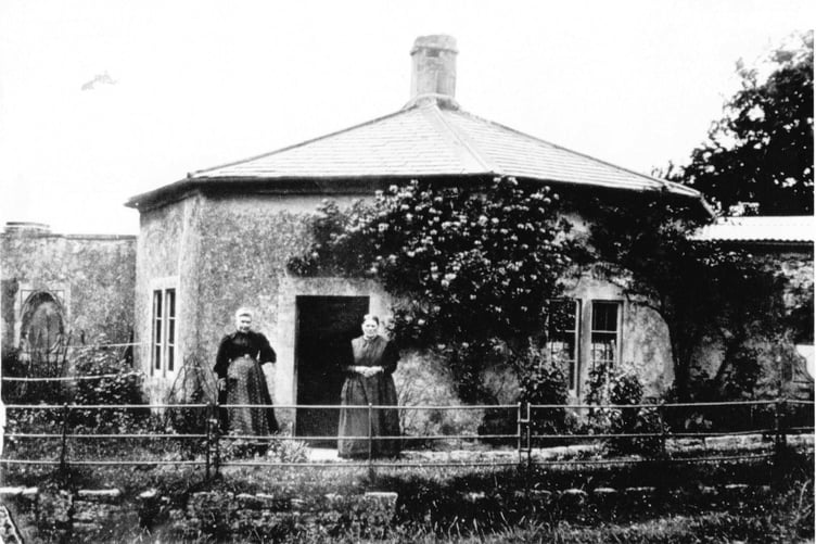
CAN you guess where this week’s Mystery Photograph was taken?
Each week, the Journal invites readers to test their knowledge by identifying a historic location from days gone by, and last week we featured a picture supplied by Radstock Museum.
We had just one entry from reader Jeff Parson who emailed in to say: “Your photo this week looks very much like the Mill Lane Bridge at Monkton Combe. This site eventually became part of the site of Monkton Combe station.”
And he is correct. The photograph shows Somersetshire Coal Canal at Monkton Combe taken around 1910.


Well done to all our readers who guessed correctly at home.
The Somersetshire Coal Canal (S.C.C.) was authorised by an Act of Parliament in 1794 and built around 1800, starting in the basins of Paulson and Timsbury, to join the Kennet and Avon Canal.
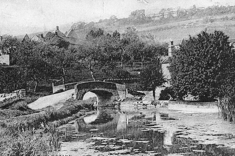
It was promoted by the mine owners of the North Somerset coalfields as a cheaper means of transporting their coal to the markets of Bath and Wiltshire, replacing pack horses, and horse and cart.
According to the Somerset Coal Canal Society, the canal “became one of the most successful in the country and, by the 1820s was carrying over 100,000 tons of coal per year.” Unfortunately the prosperity of the canal was short-lived as the onset of the railways made them eventually redundant with some of the local coal seams worked-out.
The abandoned canal was sold to Great Western Railway around about the time of this photograph, who then built a railway line over much of it.
Our thanks again go to Radstock Museum for the latest supply of Mystery Photographs. They have sent in this week’s too. If you know where it is, then let us know.
Submit your answers as ever to the Journal via email at: [email protected]
Comments
This article has no comments yet. Be the first to leave a comment.